运行Point2Grid
先使用ASCII2NC,转化为NetCDF格式
运行PointsGrid
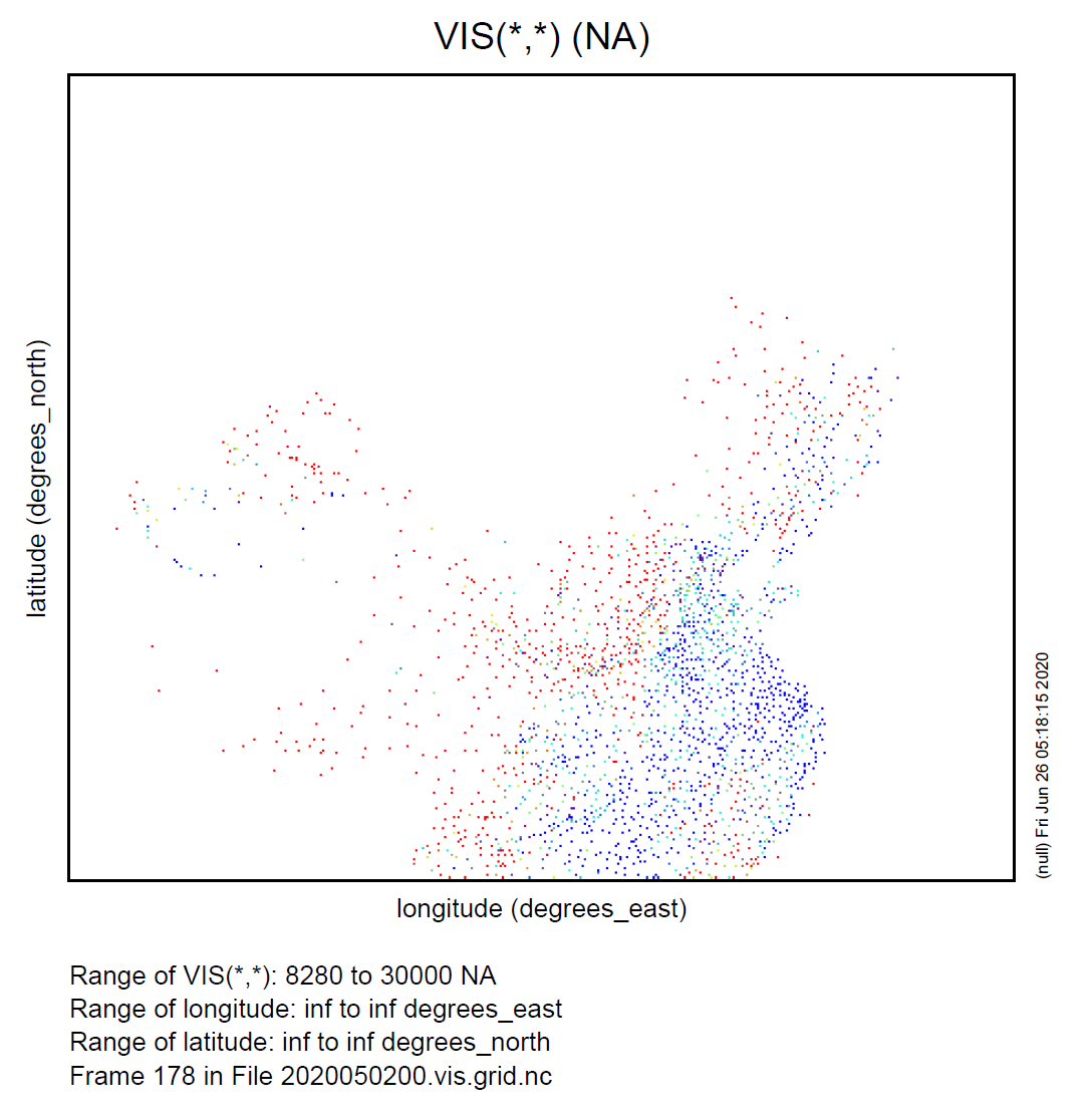
例如:制作能见度格点分析场
$ ~/METplus-3.0.1/build_components/bin/point2grid 2020050200.vis.nc rap.t21z.wrfprsf27.grib 2020050200.vis.grid.nc -field 'name="VIS"; level="(*,*)";' -v 2
DEBUG 2: Output grid: Projection: Lambert Conformal Nx: 426 Ny: 363 Lat_LL: 19.811 Lon_LL: -79.649 Lon_orient: -105.000 Alpha: 878.748 Cone: 0.716 Bx: 212.5401 By: 648.7291
DEBUG 2: Interpolation options: method = UW_MEAN, vld_thresh = 0.5
DEBUG 1: Reading data file: 2020050200.vis.nc
DEBUG 2: process_point_file() ->  var_count=2293, grid: 2159 out of 154638
DEBUG 1: Writing output file: 2020050200.vis.grid.nc
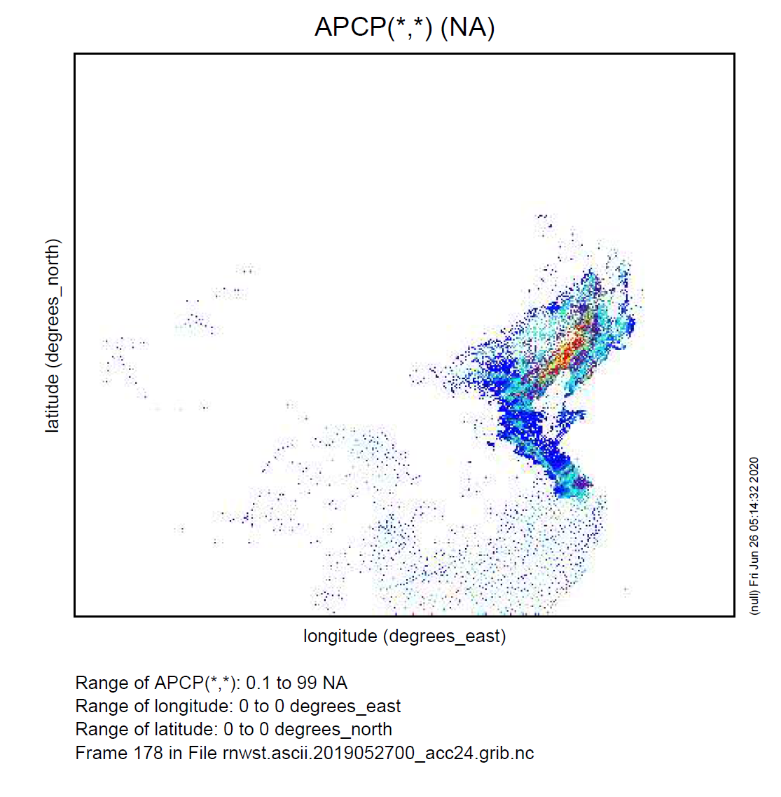
例如:制作降水格点分析场
$ ~/METplus-3.0.2/build_components/bin/point2grid rnwst.ascii.2019052700_acc24.nc rap.t21z.wrfprsf12.grib2 rnwst.ascii.2019052700_acc24.grib.nc -field 'name="APCP"; level="(*,*)";' -v 2
DEBUG 2: Output grid: Projection: Lambert Conformal Nx: 426 Ny: 363 Lat_LL: 19.811 Lon_LL: -79.649 Lon_orient: -105.000 Alpha: 878.     748 Cone: 0.716 Bx: 212.5401 By: 648.7291
DEBUG 2: Interpolation options: method = UW_MEAN, vld_thresh = 0.5
DEBUG 1: Reading data file: rnwst.ascii.2019052700_acc24.nc
DEBUG 2: process_point_file() ->  var_count=11287, grid: 5974 out of 154638
DEBUG 1: Writing output file: rnwst.ascii.2019052700_acc24.grib.nc